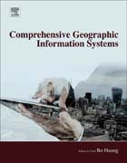
Geographical Information Systems is a computer system used to capture, store, analyze and display information related to positions on the Earth's surface. It has the ability to show multiple types of information on multiple geographical locations in a single map, enabling users to assess patterns and relationships between different information points, a crucial component for multiple aspects of modern life and industry. This 3-volumes reference provides an up-to date account of this growing discipline through in-depth reviews authored by leading experts in the field. Covers a rapidly expanding discipline, providing readers with a detailed overview of all aspects of geographic information systems, principles and applicationsEmphasizes the practical, socioeconomic applications of GISProvides readers with a reliable, one-stop comprehensive guide, saving them time in searching for the information they need from different sources INDICE: GIS Principles and Technical Designs Of GIS GIS Applications for Natural and Built Environments GIS for Socio-Economic Applications
- ISBN: 978-0-12-804660-9
- Editorial: Elsevier
- Encuadernacion: Cartoné
- Páginas: 1056
- Fecha Publicación: 01/09/2017
- Nº Volúmenes: 1
- Idioma: Inglés
